One of the first question that comes to mind when a new state is created is, does the new state have a defined territory? and the answer is a resounding YES!
The sovereign King Regis Lucius I has officially claimed his territory by his own right, and therefore it is done and awarded to the state of Tayos in international law. You see, the areas of lands which were already privatized before the creation of Tayos already belong to another foreign country and therefore can not be claimed. But the areas which were still unclaimed at the time of creation of Tayos, and therefore remained as public lands and therefore by definition did not belong to anyone as they had remained unused which forfeited any presumed prior claims, were still available and the King has evidently claimed these public land and the territory of the state of Tayos is now officially its own. The neighboring foreign states of Quebec and Canada have already been informed of this fact and have already acquiesced as it is not their choice to make and the territory of Tayos is now fact and settled in international law.
Now, it must be mentioned that while Tayos does have areas of lands as its own, it is not the full extent of its territory, as Tayos is an international state, and therefore citizens are always within the territory of their homeland no matter where they are in the world, and for this reason they always benefit from the protection of their home state no matter where they are. This also means that citizens of Tayos do not have to physically move to the lands of Tayos to be part of the state, and as long as they have citizenship, they are part of Tayos anywhere in the world.
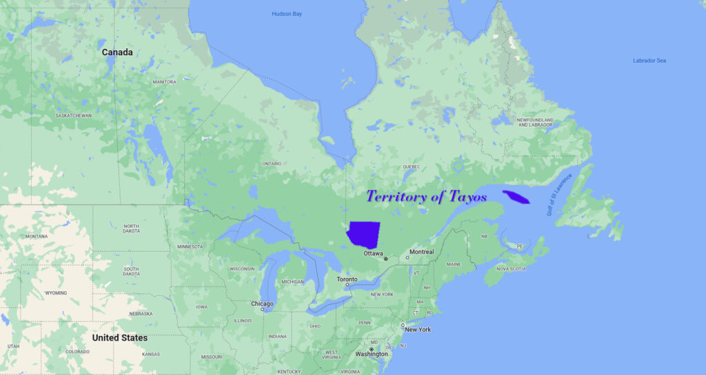
Now despite the international nature of the territory, the physical “homeland” of the state is mostly concentrated on two major areas which are here exemplified:
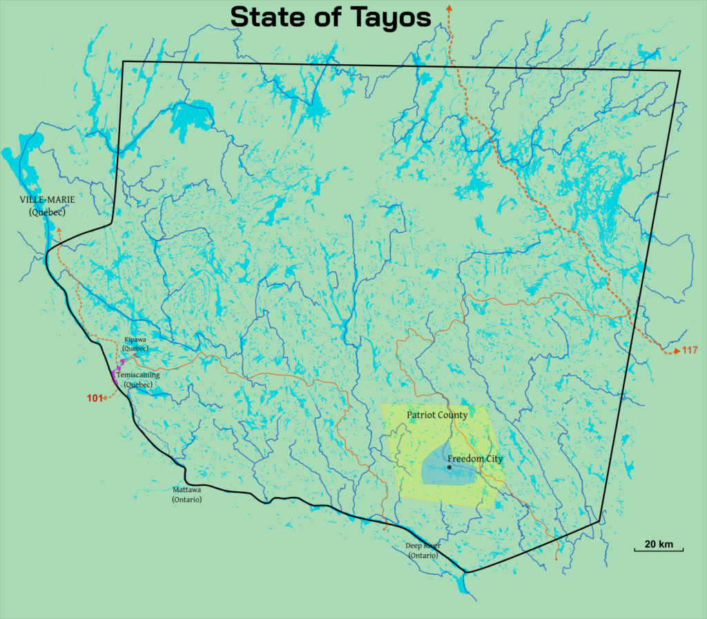
The “mainland” is composed of the following area, which is where the state intends to begin developing its core nation, and most importantly, where will be established its capital city. the area is composed of the northern banks of the “ottawa river”, north of the foreign town of “mattawa”. The city of Freedom can be seen in the southern portion.
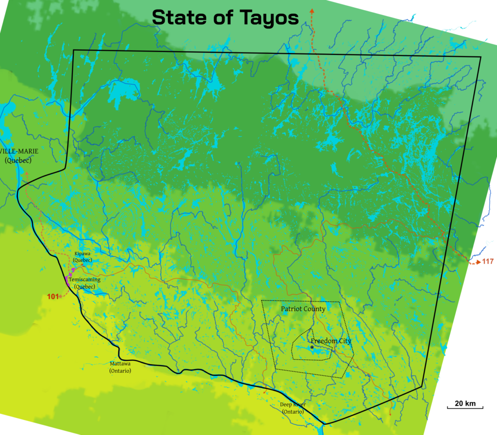
The weather of the state and its hardiness zones can be ascertained here:
A more detailed map of this area can be accessed here: Map of mainland
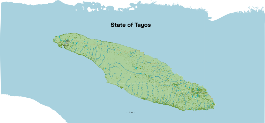
The state also has an alternative claim to the public lands of anticosti island, in the case where a colony with access to the physical sea would be desirable:
Therefore it is in these areas that the first people of Tayos will colonize and begin building their new homes under their own authority. In the future, as the state grows, it will surely claim a larger territory as the need increases, quite possibly in other areas around the world.
A more detailed map of this area can be accessed here: Map of anticosti